


Severe weather hits Houston overnight, followed by a break in the rain before the next round tonight.
Watching multiple cold fronts swing this week
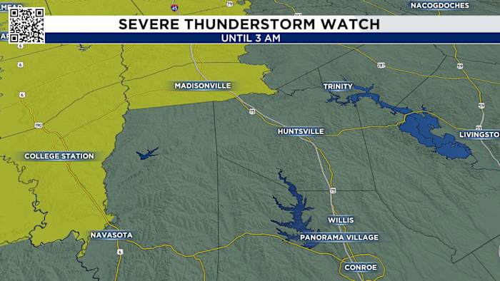
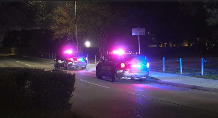
Power outages, tornado threats, heavy downpours, and gusty winds were real realities overnight as we tracked powerful thunderstorms ahead of tonight’s front. Sunday night into the early morning hours, we face the same dangers: severe thunderstorms, winds up to 60 mph, hail, and the potential for another round of tornado warnings.
We’ll get a break from the storms by this afternoon - but we’ll keep a close eye on the chance for developing storms to the west and north of Houston by 5 pm. 
We’ll start to see the chance for stronger storms move into the downtown Houston area around 7 and areas to the north.
We’ll watch for the storms to start to build from Lake Jackson, Katy to The Woodlands by 10 tonight.
And by midnight we’ll watch our storms push off the coast bringing the chance for strong storms in Lake Jackson and Galveston.
In fact, because we have been so dry for over a month, if some areas get too much rain too quickly, that’s a good recipe for possible street flooding in some areas. 
That’s why we’re under a 2 out of 4 threat for flash flooding on Saturday. 
And remember, since we do have a small tornado threat, you’ll want to make sure your phone’s volume is up and alerts are ON — that way you’ll be woken up if a warning is issued while you’re asleep.
Elevated Fire Risk:
Burn bans are remain in effect across the area with only a few counties left without bans. While the introduction of some rain chances this week are good in terms of bringing some rain chances, however, we would need a few weeks in a row of consistent fronts with lots of rain before they would likely take off some of the burn bans. 
- Avoid spark-causing activities, as fires can flare up fast.
- Never leave a fire burning unattended or without purpose.
- Secure tow chains to prevent dragging and sparking.
- Don’t drive or park over tall grass.
- Avoid tossing lit cigarettes onto the ground.
Your extended forecast:
Our strongest cold front this season moves through next Tuesday bringing temperatures in the 70s with sunny skies and lows in the 50s. Just in time for Halloween!
Click 2 Pins
If you notice interesting weather in your neighborhood, share your photos and videos with KPRC 2 at Click2Pins!