


Rain chances finally return to Houston ahead of weekend cold front
A third straight week of bone dry weather may get a little relief from a weekend cool front

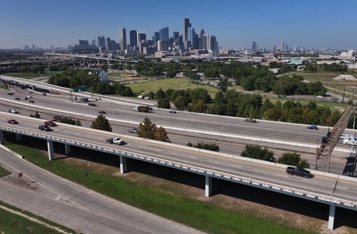
The Houston area is on track for a change in the weather pattern, with showers and cooler air expected to arrive by this weekend.
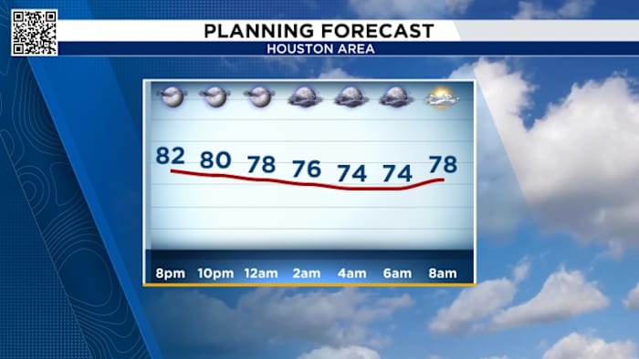
Rain chances will start to increase Thursday afternoon, with the possibility of a sprinkle or two, but overall precipitation is limited.
Thursday’s Forecast:

Weekend Rain Chance:
The main window for showers and possible thunderstorms is expected to open Friday afternoon into Friday night as the front moves closer to Houston. While the majority of the front’s activity is forecast to remain north of the city, scattered showers and light thunderstorms could make outdoor plans a bit damp, especially for Friday night events. 
Elevated Fire Risk
We continue to monitor fire dangers across SE Texas. Waller County went under a burn ban Wednesday. Harris County will vote on Thursday regarding a potential burn ban.
Dry, warm weather is expected to persist through most of this week with another period of elevated fire risk anticipated. Even when we start to see a little more humidity by the end of the week, we’re running well below normal for rainfall so far this fall.
- Avoid spark-causing activities, as fires can flare up fast.
- Never leave a fire burning unattended or without purpose.
- Secure tow chains to prevent dragging and sparking.
- Don’t drive or park over tall grass.
- Avoid tossing lit cigarettes onto the ground.
We will likely see more counties added to the list through the next few weeks, especially if we stay in this hot and dry pattern, which appears that we will.
Tracking the tropics:
Tropical Storm Lorenzo is churning out at sea with sustained winds of 60 mph, but it’s expected to stay in the central Atlantic before weakening into the weekend. 
Your extended forecast:
Afternoons will still stay warm and we’ll see more humidity by the end of the week as a front will brings showers and thunderstorms Friday and Saturday. And it looks like our next fall morning looks to be at the end of the 10 day forecast.
If you notice interesting weather in your neighborhood, share your photos and videos with KPRC 2 at Click2Pins!