


Wonderful Wednesday behind Tuesday’s cold front in Houston
Watching multiple cold fronts swing this week
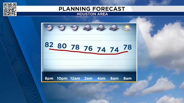
Tonight’s Forecast:
Tonight we will be tracking scattered shower and storm chances through the early evening. Track our radar below.
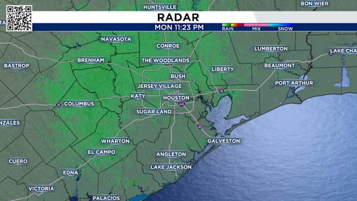
Then we’ll watch for the front to push through bringing the chance for storms for our coastal communities by dinner time on Tuesday. Temperatures fall through the 70s and into the 60s for Wednesday morning.
Wednesday’s Forecast
Wednesday will feel spectacular with low humidity and highs in the 70s and lower-80s! Clouds will stick around south of I-10, but to the north expect sunny skies!
Elevated Fire Risk:
Burn bans are remain in effect across the area with only a few counties left without bans. While the introduction of some rain chances this week are good in terms of bringing some rain chances, however, we would need a few weeks in a row of consistent fronts with lots of rain before they would likely take off some of the burn bans. 
- Avoid spark-causing activities, as fires can flare up fast.
- Never leave a fire burning unattended or without purpose.
- Secure tow chains to prevent dragging and sparking.
- Don’t drive or park over tall grass.
- Avoid tossing lit cigarettes onto the ground.
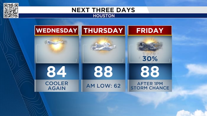
Your extended forecast:
Our next cold front comes at the end of next week to keep our highs into the mid-80s.
Our weekend front will also bring our next substantial chance for rainfall with the whole area having the potential to see over an inch of needed rainfall.
Click 2 Pins
If you notice interesting weather in your neighborhood, share your photos and videos with KPRC 2 at Click2Pins!


